|
|
Post by Jim on Mar 1, 2019 16:48:48 GMT
Apakah dia ada di papan selancar? Are you trying to pretend you clever? Definitely pretending! |
|
|
|
Post by kris on Mar 1, 2019 16:59:09 GMT
Is that it? The best you've got. |
|
|
|
Post by patty on Mar 1, 2019 17:18:39 GMT
Back to the subject...sounds quite scary for a solo take care and keep posting...
|
|
|
|
Post by Jim on Mar 1, 2019 17:31:51 GMT
On our trip I was at the helm all that time, but I had a chef to provide butties and brews. It was a cold autumn day, on a Dawncraft 22, so got the fire going, opened the cabin door and sat on a box with hand on the wheel, looking through the door and cabin front windows, warm and toasty. It could get nippy on the back of a NB in the open.
|
|
|
|
Post by TonyDunkley on Mar 1, 2019 19:18:29 GMT
Got it! Looks like a good read!  I've heard from numerous pleasure boaters who have used them that these Charts/Pilotage guides are very good, but I'm intrigued as to why there appears to have been a need for 14 amendments to them. In the 58 years since my first introduction to it, the Trent's deep water navigation channel hasn't changed significantly, if at all, from the upper limit of navigation at Wilden Ferry, Shardlow to where it joins the (Yorkshire) Ouse at Trent End/Apex Light/Trent Falls and becomes the Humber, and the tide still finds it's way up to Cromwell Lock twice a day. Do any TB'ers have earlier editions that could be compared with the version that Welly has got ? |
|
Deleted
Deleted Member
Posts: 0
|
Post by Deleted on Mar 1, 2019 19:59:16 GMT
Not me, god forbid ! It's a RIVER ! I'll stay on my muddy ditches ... contentedly  Rog |
|
|
|
Post by TonyDunkley on Mar 2, 2019 0:04:20 GMT
Got it! Looks like a good read! Do any TB'ers have earlier editions [of this Tidal Trent guide] that could be compared with the version that Welly has got ? I've tried without success to post the photo in this link : < i.ibb.co/khcQYqj/DSCF4567.jpg > It appeared in a CWDF thread a couple of days ago, was taken from a Trent outbound vessel which was just leaving Apex Light astern, and going by the colour of the water, the appearance of the surface near the light, and the amount of half-tide training wall that's showing back towards North Trent Light, fairly early on a Neap Flood . As a sample test of just how useful these charts/guides are, could Welly or anyone else who has a copy tell me if it appears that the boat the photo was taken from is following the deep water channel as marked in the Tidal Trent chart/guide ? |
|
|
|
Post by JohnV on Mar 2, 2019 18:10:48 GMT
Do any TB'ers have earlier editions [of this Tidal Trent guide] that could be compared with the version that Welly has got ? I've tried without success to post the photo in this link : < i.ibb.co/khcQYqj/DSCF4567.jpg > It appeared in a CWDF thread a couple of days ago, was taken from a Trent outbound vessel which was just leaving Apex Light astern, and going by the colour of the water, the appearance of the surface near the light, and the amount of half-tide training wall that's showing back towards North Trent Light, fairly early on a Neap Flood . As a sample test of just how useful these charts/guides are, could Welly or anyone else who has a copy tell me if it appears that the boat the photo was taken from is following the deep water channel as marked in the Tidal Trent chart/guide ? doesn't look like it according to my copy of the guide looks well over towards Tackhammer ..... and definitely not the course I would be taking Just took a pair of dividers to the Trent guide chart and it shows the deep channel to be almost mid point at Apex, which doesn't concur with John Dean's route. He keeps pretty tight against the retaining wall until actually passing Apex and then aims for the first marker .... which if my memory serves me is the red on the post. Apex from the Jade Lift late on the ebb 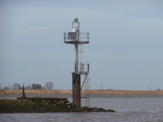 SAM_2187 SAM_2187 by mudlarker2, on Flickr |
|
|
|
Post by TonyDunkley on Mar 2, 2019 19:41:24 GMT
I've tried without success to post the photo in this link : < i.ibb.co/khcQYqj/DSCF4567.jpg > It appeared in a CWDF thread a couple of days ago, was taken from a Trent outbound vessel which was just leaving Apex Light astern, and going by the colour of the water, the appearance of the surface near the light, and the amount of half-tide training wall that's showing back towards North Trent Light, fairly early on a Neap Flood . As a sample test of just how useful these charts/guides are, could Welly or anyone else who has a copy tell me if it appears that the boat the photo was taken from is following the deep water channel as marked in the Tidal Trent chart/guide ? doesn't look like it according to my copy of the guide looks well over towards Tackhammer ..... and definitely not the course I would be taking Just took a pair of dividers to the Trent guide chart and it shows the deep channel to be almost mid point at Apex, which doesn't concur with John Dean's route. He keeps pretty tight against the retaining wall until actually passing Apex and then aims for the first marker .... which if my memory serves me is the red on the post. Apex from the Jade Lift late on the ebb SAM_2187 by mudlarker2, on Flickr Well, that puts a big question mark over the value of these so-called Trent charts ! The boat that photo was taken from was indeed perilously close to parking itself on Tackhammer. To find the deepest water, Trent outbounds should be no more than 25 - 30 yards off the half-tide wall and posts all the way to Apex Light from somewhere between South Trent and North Trent Lights. It would be interesting to know the course/lines they mark at the places where I've seen most pleasure craft grounded *, ie. just topside of Carlton Wharf, Girton Stakes, Normanton Island, Spring Head, Milking Boat, the ness at the low end of Dunham Dubs, Pinfold, and Maltkilns.
* Nick Norman - please note that this reference to 'grounding' is nothing to do with 'earth' polarity in low voltage DC circuits. |
|
|
|
Post by JohnV on Mar 2, 2019 20:27:11 GMT
|
|
|
|
Post by JohnV on Mar 2, 2019 23:25:09 GMT
doesn't look like it according to my copy of the guide looks well over towards Tackhammer ..... and definitely not the course I would be taking Just took a pair of dividers to the Trent guide chart and it shows the deep channel to be almost mid point at Apex, which doesn't concur with John Dean's route. He keeps pretty tight against the retaining wall until actually passing Apex and then aims for the first marker .... which if my memory serves me is the red on the post. Apex from the Jade Lift late on the ebb SAM_2187 by mudlarker2, on Flickr It would be interesting to know the course/lines they mark at the places where I've seen most pleasure craft grounded *, ie. just topside of Carlton Wharf, Girton Stakes, Normanton Island, Spring Head, Milking Boat, the ness at the low end of Dunham Dubs, Pinfold, and Maltkilns. hope the pictures in the above post might help ..... trouble is the landmarks you use are not the ones they use so to a certain extent I've had to guess not very good pictures but the best I can do without rigging up the scanner ..... which I've got somewhere or another  |
|
Deleted
Deleted Member
Posts: 0
|
Post by Deleted on Mar 5, 2019 13:30:56 GMT
A dry exhaust on a narrow boat means a skin tank. Why do you think there is no skin tank? I bet there is one. Eta it is perfectly normal on a narrow boat to have a skin tank and a heat exchanger cooled engine. I take it back. Mechanic is round now and I do have a skin tank (as well as the heat exchanger). Now I know! He's pointed it out to me. |
|
|
|
Post by Telemachus on Mar 5, 2019 14:15:30 GMT
Apakah dia ada di papan selancar? Are you trying to pretend your clever? No, just trying to pretend he’s Indonesian/Malaysian. |
|
|
|
Post by Telemachus on Mar 5, 2019 14:23:09 GMT
Grounding: yes Tony, as I said repeatedly, context is everything!
Anyway, we have Edition 13 from perhaps 4 years ago. I don’t expect the core navigation channel markings have changed much if at all, but there is a lot of info about stuff on the banks (landmarks etc) and I suppose building get demolished, building get erected etc etc so maybe that is the sort of info that is updated. Unfortunately updates are not marked or listed.
|
|
|
|
Post by naughtyfox on Mar 5, 2019 17:00:32 GMT
Not me, god forbid ! It's a RIVER ! Shake in your wellies Fearless Dogless! (haha! geddit, Welly?). We are going to nip down the Terrible Trent in our little tub as far as Keadby. Have it down as around July 2023. |
|